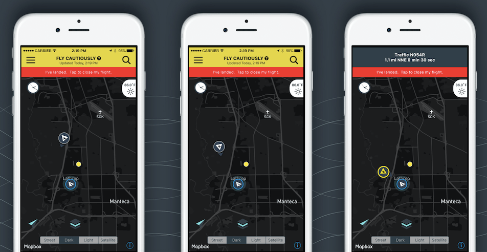
In an age where drones are making headlines for everything from pizza deliveries to aerial photography, the need for safe navigation in our crowded skies has never been more pressing. Enter AirMap, a pioneering startup based in Santa Monica that is empowering drone operators to avoid conflicts with manned aircraft through real-time traffic alerts. With their innovative technology, they are not just changing the way we think about drones but are also charting a safer future in aviation.
Understanding AirMap’s Innovative Approach
At the heart of AirMap’s technology lies a sophisticated system capable of processing airborne data from thousands of both drones and manned aircraft simultaneously. According to co-founder and CEO Ben Marcus, the company provides crucial information, enabling drone users to know where they can safely fly and what airspaces are off-limits due to safety concerns. The unique algorithms developed by AirMap assess the potential intersections of flight paths, ensuring that drones can maneuver through the skies without risking collision with helicopters, crop dusters, or low-flying planes.
Real-Time Traffic Alerts: A Game Changer
The standout feature of AirMap’s service is its real-time traffic alerts. Operators can receive immediate notifications if a manned aircraft is about to enter their airspace, which is vital for maintaining safety. This state-of-the-art functionality is made possible through partnerships with other industry leaders. For instance, AirMap collaborates with Passur Aerospace Inc., which utilizes radar technology for real-time tracking of aircraft, and uAvionix, known for its lightweight ADS-B sensors that facilitate communication between manned and unmanned aircraft.
The Role of Data Partnerships
Without these strategic partnerships, the capabilities of AirMap would be significantly limited. The collaboration with Passur Aerospace provides crucial detection technology and data that enhances AirMap’s overall offering. Similarly, uAvionix’s sensor technologies allow drones to share pertinent information, paving the way for safer interaction between various flying vehicles. These partnerships not only enhance the functionality of AirMap’s platform but also solidify its position as a key player in the drone ecosystem.
Looking Ahead: The Future of Drone Operations
The importance of safety in drone operations cannot be understated as the technology grows more common. Gregory McNeal, AirMap’s co-founder and a law professor at Pepperdine University, emphasized the need for collaboration in the growing drone industry in his keynote at the recent Interdrone conference. He argues that a united effort towards safety will enable an era of effective and secure drone use across various sectors.
Conclusion
As AirMap continues to expand its offerings and enhance its technology, drone operators are benefiting from unparalleled insights into airspace safety. With real-time traffic alerts and collaborative data partnerships, AirMap is establishing a new standard for drone navigation, ensuring that these remarkable flying machines operate safely alongside traditional aircraft. The future of drones is bright, and with advancements like those from AirMap, it is clear that safety will remain a top priority.
For more insights, updates, or to collaborate on AI development projects, stay connected with [fxis.ai](https://fxis.ai).
At [fxis.ai](https://fxis.ai), we believe that such advancements are crucial for the future of AI, as they enable more comprehensive and effective solutions. Our team is continually exploring new methodologies to push the envelope in artificial intelligence, ensuring that our clients benefit from the latest technological innovations.

